Land Seismic Data Processing
Complete 2D and 3D Land Data Processing Suite in g-Platform
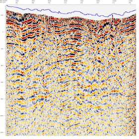
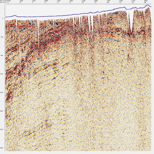
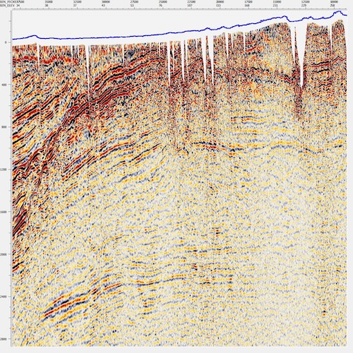
Geomage delivers end-to-end land (onshore) seismic data processing using g-Platform™. The typical 2D and 3D land seismic workflow progresses from data loading and geometry assignment — supported by integrated QC tools — through spherical divergence correction, surface-consistent amplitude correction, noise attenuation, and surface-consistent deconvolution.
Refraction static corrections use both GLI and tomographic methods to resolve near-surface velocity variations, followed by iterative velocity analysis and residual static corrections for optimal stacking.
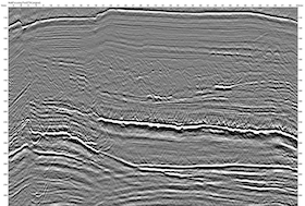
For 3D land data, additional steps include 5D interpolation and regularization to fill acquisition gaps, footprint attenuation to remove systematic amplitude patterns.
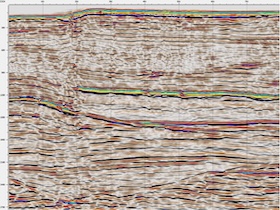
High-Resolution Radon-based demultiple is followed by anisotropic pre-stack time migration (APSTM) to ensure accurate structural positioning and imaging accuracy. Both workflows conclude with AVO attribute extraction, angle stacks, and pre-stack depth migration (PSDM) where subsurface complexity demands it.
Geomage's processing team handles the full range of land acquisition challenges: rough topography, frost zones, sparse 3D with low fold, wide-azimuth (WAZ) surveys, 3D merges, and 4D time-lapse processing for reservoir monitoring.
Related g-Platform Solutions
Geomage's processing services leverage the same cutting-edge technology embedded in the g-Platform™ software:
- Refraction Statics — GLI and tomographic near-surface solutions
- First-break Picking — automatic and interactive first-break detection
- Signal Processing — noise attenuation and spectral shaping
- Stack Imaging — NMO, CMP stacking, and MultiFocusing-enhanced imaging
- Time Imaging — Kirchhoff Anisotropic Pre-Stack Time Migration (APSTM) with accurate velocity model building and higher-order moveout corrections tuning
- Depth Imaging — Kirchhoff Pre-Stack Depth Migration (PSDM) for complex overburden
Ready to improve your land seismic results?
Contact our processing team or download g-Platform to run your own workflows.