

Seismic Data Processing & Imaging Software

Seismic processing software

One platform from field tape to depth image.

g-Platform is a complete 2D/3D/4D/VSP seismic processing and imaging system — geometry & QC, statics, denoise & demultiple, deconvolution, 5D interpolation, time imaging, anisotropic depth imaging (PreSDM, RTM/FWI) and VSP — with GPU acceleration and HPC cluster scaling.

2D/3D/4D/VSP
Processing & imaging
CPU + GPU
HPC cluster scaling
No limit
On data size
Interactive seismic velocity analysis in g-Platform
First-break picking and refraction statics
Geometry, fold and offset QC maps
5D interpolation and geometry regularization in g-Platform
MultiFocusing imaging result
In view
Velocity analysis
2D/3D/4D
+ VSP processing
3
Domains: time, depth & VSP
8+
Seismic data formats
No limit
On data size
CPU + GPU
Cluster, on-prem or cloud
Win / Linux
OS compatibility
g-Platform is a complete seismic processing and imaging software solution — a friendly user interface, advanced graphics, precise algorithms and full utilization of parallel processing. It covers the full imaging chain end to end across Time Imaging, Depth Imaging and VSP Processing in one unified environment. Built on Geomage's proprietary, patented technologies — including MultiFocusing and Diffraction — it reads all common seismic formats with no limitation on data size, applies production-grade algorithms (stereo tomography, anisotropic Kirchhoff PreSDM, RTM/FWI, full-azimuth SRME, HR Radon and Fourier 5D interpolation), and dispatches every step across CPU clusters and NVIDIA GPUs through a built-in job scheduler — with a structured project tree, batch processing, and a Python / ChatGPT plug-in for automation.
The full imaging chain

Every processing stage. One environment.

From field-tape geometry to anisotropic depth images and VSP — production-grade algorithms across the entire workflow, all on a single platform.

Geometry and fold QC maps
DATA & GEOMETRY

Data Input, Geometry & Binning

Every common format, no data-size limit

Load all common seismic formats and build geometry through an interactive, fully synchronized interface, with 2D crooked-line and 3D flexi-binning and sophisticated QC.

  • SEG-Y, SEG-D (rev. 1-3, CRG), SEG-2, SEG-B, SEG-RODE, 80.XX, MiniSEED
  • Geometry from Headers, SPS, Observer logs, P1/90 UKOAA, NAV
  • 2D crooked-line & 3D flexi-binning with automatic boundary detection
  • QC: fold / offset distribution, rose diagram, header cross-plots, first breaks
  • No data-size limit; any geometry or data format on demand
Refraction statics and first-break QC
STATICS

Surface-Consistent Statics

First breaks to refraction & residual statics

Automatic and manual first-break picking feeding model-free, weathering and tomographic refraction statics, plus surface-consistent residual statics — with extensive QC.

  • First-break picking (several algorithms) in CS/CR/CO, LMO constant/trend
  • Refraction statics: model-free, weathering (drift), tomography 2D/3D
  • Uphole / source-delay statics; SC residual statics 2D/3D/4D
  • QC: coverage & editing, velocity model, solver convergence, location map
Pre-stack gathers, noise and multiple attenuation
DENOISE & DEMULTIPLE

Noise & Multiple Attenuation

Denoise and demultiple, land & marine

A full denoise toolkit across domains plus advanced demultiple, including full-azimuth SRME and surface-related multiple prediction.

  • Ground roll (AGRA), swell noise, radial, FK/Tau-p, FX/FXY, FDNA
  • Cadzow & 3D footprint attenuation; despike / clipping; PZ summation
  • Multiple: Tau-p Decon, HR Radon, full-azimuth SRME (true azimuth), SRMP
  • Deghost / designature / debubble; adaptive subtraction
Deconvolution and amplitude processing
DECONVOLUTION & AMPLITUDE

Deconvolution & Amplitude

Spectral shaping & amplitude recovery

Deconvolution, spectral whitening and Q compensation paired with amplitude recovery and balancing for clean, balanced gathers.

  • Deconvolution: Gabor, Wiener, FX-Decon, predictive
  • Band-pass / notch; spectral whitening (simple, time-variant)
  • Q compensation (time-variant, horizon-based)
  • Spherical divergence, AGC / balance, time-variant balance
5D interpolation and geometry regularization
REGULARIZATION & 5D

Regularization & 5D Interpolation

Densify and regularize geometry

Geometry regularization and high-resolution 5D interpolation via both HR Radon and Fourier engines, plus supporting interpolations.

  • Regularization: densify, spiral, polar, S/R regular geometry
  • 5D interpolation: HR Radon & Fourier engines, offset-azimuth segments
  • 2D to pseudo-3D; FK interpolation; trim statics
Velocity analysis and time migration
VELOCITY & TIME IMAGING

Velocity, Stack & Time Imaging

NMO stack through PreSTM with anisotropy

Velocity analysis and stack imaging feeding pre- and post-stack Kirchhoff time migration with ETA/VTI anisotropy and OVT — with a full migration VA loop, on GPU.

  • NMO 2nd/4th order, velocity picking (interactive/auto), CVS/CPS, multi-line
  • Kirchhoff Post-STM; Pre-STM with ETA anisotropy / OVT, variable aperture, VTI
  • Migration VA & update, RMO, angle/offset stacks & muting
Anisotropic depth imaging result
DEPTH IMAGING

Depth Imaging — PreSDM, RTM/FWI

Anisotropic velocity model building & migration

End-to-end depth imaging from velocity model building through anisotropic Kirchhoff PreSDM and RTM/FWI, with a dedicated salt-dome workflow and well-tie.

  • Velocity: grid & stereo tomography, coherency inversion, Dix, Eikonal
  • Kirchhoff PreSDM — isotropic, VTI (2D/3D) and TTI (3D) anisotropic
  • Dedicated salt-dome velocity-building workflow (2D/3D)
  • RTM & FWI (2D/3D, GPU); residual depth move-out; depth-to-time conversion
VSP corridor processing and imaging
VSP PROCESSING

VSP Processing & Imaging

Full borehole workflow to migrated image

A dedicated VSP 2D/3D package spanning the full Vertical Seismic Profile workflow from geometry building through Kirchhoff and RTM VSP imaging.

  • VSP geometry, VSP-to-CDP conversion / CDP mapping, first-break picking
  • Wave separation, median filter, velocity inversion, tomography
  • VSP NMO / stack / corridor mute; acoustic modeling; time-depth conversion
  • VSP imaging: Kirchhoff & RTM 2D/3D, interactive 2D/3D application
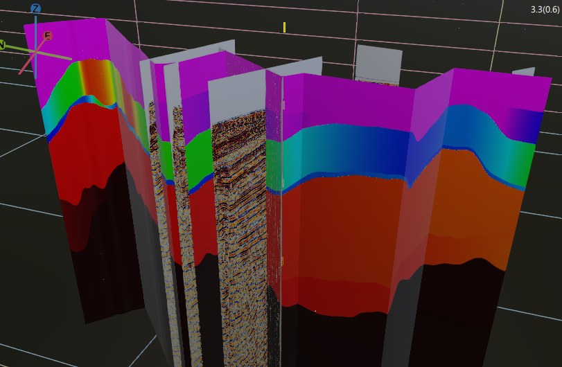
3D depth image with wells produced in g-Platform
PLATFORM · HPC · WORKFLOW

Built for production at HPC scale

Project tree · batch · job scheduler · GPU cluster

A structured project environment with batch processing and a built-in job scheduler that distributes work across the g-Cluster eco-system — master servers and CPU/GPU nodes, on-premises or in the cloud.

  • Project logical tree, workflows, revision history, templates
  • Batch processing by dataset / parameters; global properties; monitoring
  • Job scheduler with task & user prioritization and node-task assignment
  • g-Cluster: master server + Coalition scheduler + CPU/GPU nodes; NVIDIA GPU
  • Database with automatic backup; Windows / Linux compatibility
  • Python plug-in / ChatGPT integration; bundled g-Viewer SEG-Y visualization
Time-Imaging Packages

License exactly what your survey needs.

Time Imaging is delivered in four packages — so acquisition crews, land and marine processors, and full-chain shops each get the right module set. Depth Imaging and VSP are available as their own packages.

In-field / onboard
Acquisition QC
4 CPU cores

Geometry and data quality control in the field or onboard — data loading, nominal geometry handling and QC.

Onshore
Land
8 CPU cores · Cluster/GPU option

Full refraction & residual statics, SC amplitude correction, and AGRA adaptive ground-roll attenuation for land time imaging.

Offshore
Marine
8 CPU cores · Cluster/GPU option

Vessel-speed / receiver-motion / tidal statics, deghost / designature / debubble / SRME (true azimuth) and swell-noise tools.

End to end
Full
8 CPU cores · Cluster/GPU option

All modules across land and marine, including Kirchhoff Pre-STM with ETA anisotropy / OVT and PSTM angle-stack imaging.

Universities & research institutions: g-Platform is free for teaching and non-commercial research under the Academic License Program.

End-to-end workflow

From field tape to depth image.

A continuous processing chain — no exporting between point tools, every stage on the same platform.

1
Load & build geometry
Import any common format with no data-size limit; build geometry from Headers / SPS / Observer logs / P1-UKOAA / NAV with interactive QC.
2
QC & bin
First-break QC, header cross-plots and attributes; 2D crooked-line and 3D flexi-binning validated by fold, offset and rose-diagram QC.
3
Compute statics
Model-free / weathering / tomographic refraction statics, uphole and source-delay statics, and surface-consistent residual statics.
4
Denoise & demultiple
Attenuate ground roll, swell and coherent noise; remove multiples with Tau-p / HR Radon, full-azimuth SRME and SRMP.
5
Deconvolve & balance
Gabor / Wiener deconvolution and spectral whitening, time-variant Q compensation, amplitude recovery and balancing.
6
Regularize & interpolate
Densify and regularize geometry; HR Radon or Fourier 5D interpolation, with trim statics.
7
Velocity, stack & time-migrate
NMO velocity analysis and stack, then Kirchhoff Pre/Post-STM with ETA/VTI anisotropy and OVT on GPU, plus migration VA.
8
Build velocity model & depth-migrate
Stereo/grid tomography, coherency inversion, Dix and Eikonal with anisotropic well-tie, then VTI/TTI PreSDM, salt-dome workflow and RTM/FWI.
9
Process & image VSP
Build VSP geometry, separate wavefields, invert velocities; VSP-to-CDP conversion and Kirchhoff / RTM 2D/3D VSP imaging.
10
Productionize on HPC
Track revision history, run batch jobs by dataset / parameters, extend via Python / ChatGPT, and schedule across the CPU/GPU cluster.
Why g-Platform

Differentiated physics, built for production.

Patented imaging technology
Built on Geomage's own patented MultiFocusing and Diffraction technologies — differentiated physics, not a repackaged toolbox.
One platform, three domains
Time imaging, depth imaging and VSP in a single environment, with VSP-to-CDP tying borehole results into surface seismic imaging.
Anisotropic depth imaging
VTI (2D/3D) and TTI (3D) Kirchhoff PreSDM, a dedicated salt-dome workflow, and GPU RTM/FWI — backed by stereo tomography and Eikonal engines.
Advanced demultiple
Full-azimuth SRME (true azimuth) and surface-related multiple prediction (SRMP) with adaptive subtraction, plus HR Radon and Tau-p.
Dual-engine 5D interpolation
Regularize and densify geometry with both HR Radon and Fourier 5D interpolation engines.
Built for HPC
Full parallel processing: g-Cluster eco-system with a Coalition job scheduler, prioritization, node-task assignment and NVIDIA GPU — on-prem or cloud.
No data-size limit
Reads all common formats with no limitation on data size, and any geometry or data format can be implemented on request.
Automatable & extensible
Workflow revision history, batch processing, an expression calculator, and a Python plug-in / ChatGPT integration for scripting and automation.
Data & deployment

Your formats. Your cluster.

Seismic data input
All common formats — no data-size limit, any format on demand
SEG-YSEG-D rev. 1-3SEG-D CRGSEG-2SEG-BSEG-RODE80.XXMiniSEED
Geometry
HeadersSPSObserver logsP1/90 UKOAANAV
System & HPC
Workstation to cluster — on-premises or cloud
Operating system
Windows / Linux compatible.
Compute
CPU clusters with NVIDIA GPU acceleration for migrations, depth imaging, RTM/FWI and VSP.
g-Cluster
Master server(s) + Coalition job scheduler + CPU/GPU worker nodes; task & user prioritization, node-task assignment.
Licensing
Flexible options to fit any setup — per CPU core, per GPU, and standalone (node-locked) or network (floating) licenses.
Deployment
On-premises or in the cloud; database with automatic backup and import/export.
Automation
Project tree, batch processing, expression calculator, and a Python plug-in / ChatGPT integration.
Included
Bundled g-Viewer SEG-Y visualization software.
The Geomage family

Processing that feeds interpretation.

g-Platform seismic imaging
You are here
g-Platform
Full-scale 2D/3D/4D/VSP seismic processing and imaging — time, depth and VSP — on CPU/GPU clusters.
g-Space interpretation
Interpretation
g-Space
Integrated seismic interpretation and 3D geomodeling. Pairs with g-Platform for iterative processing-to-interpretation loops.
Explore g-Space
g-Viewer
Bundled
g-Viewer
SEG-Y visualization & QC, bundled with g-Platform so teams can review data and results anywhere.
Explore g-Viewer
FAQ

Questions, answered.

What does g-Platform do?
It is a complete 2D/3D/4D/VSP seismic data processing and imaging solution covering the full chain end to end: data input and geometry, QC and binning, statics, denoise and demultiple, deconvolution and amplitude, regularization and 5D interpolation, velocity analysis and time imaging, anisotropic depth imaging (PreSDM, RTM/FWI), and VSP processing and imaging.
Which seismic data formats are supported?
SEG-Y, SEG-D (rev. 1-3, including CRG for wireless geophones), SEG-2, SEG-B, SEG-RODE, 80.XX and MiniSEED, with geometry from Headers, SPS, Observer logs, P1/90 UKOAA and NAV. Any other geometry or data format can be implemented on demand, and there is no limitation on data size.
How are the Time-Imaging packages structured?
Time Imaging is delivered in four packages — Acquisition QC, Land, Marine and Full — so teams license exactly the modules their survey type and stage need. Acquisition QC focuses on data loading and QC (4 CPU cores); Land, Marine and Full each include 8 CPU cores. Land adds full refraction/residual statics and AGRA ground-roll attenuation; Marine adds receiver-motion/tidal statics, deghost/designature/debubble/SRME and swell-noise tools; Full covers both end to end. Depth Imaging and VSP are available as their own packages.
Does g-Platform support GPU and cluster processing?
Yes. It fully utilizes parallel processing through the g-Cluster eco-system — master server(s), an HPC CPU/GPU cluster and a Coalition job scheduler — with NVIDIA GPU acceleration for migrations, depth imaging, RTM/FWI and VSP imaging. It deploys on-premises or in the cloud and runs on Windows and Linux.
What depth-imaging algorithms are available?
Velocity model building via grid and stereo tomography, coherency inversion, Dix transform and Eikonal travel-time tables; isotropic, VTI (2D/3D) and TTI (3D) anisotropic Kirchhoff PreSDM; a dedicated salt-dome velocity-building workflow; depth-domain RMO correction; and RTM/FWI in 2D/3D on GPU.
Can the platform be automated or extended?
Yes. It provides workflow revision history, batch processing by dataset / module parameters / common variables, an expression calculator, and a Python plug-in with ChatGPT integration for scripting and automation. Geomage also delivers constant new features, bug fixes, auto-update, and online support and training.
Get started

See g-Platform on your data.

From acquisition QC to anisotropic depth imaging and VSP — one platform, your formats, your cluster. Talk to Geomage about a demo, a benchmark, or the package that fits your survey.