Seismic data processing
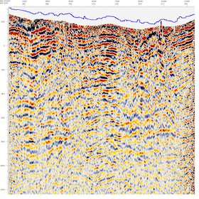
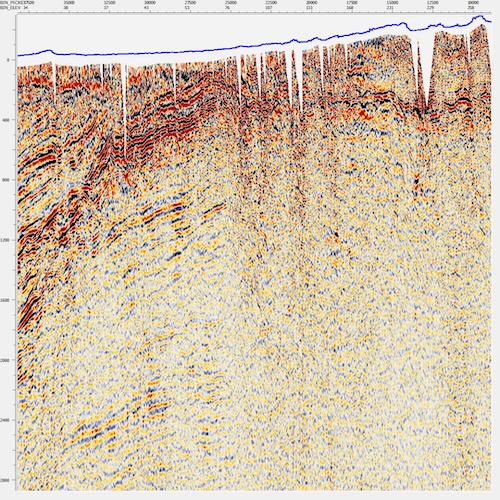
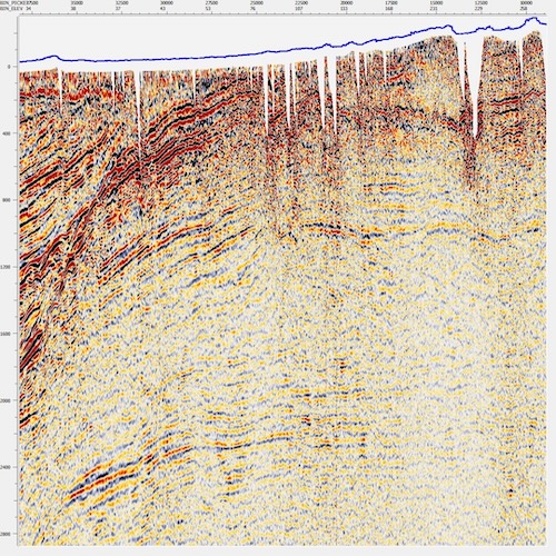
Onshore seismic processing
Marine seismic processing
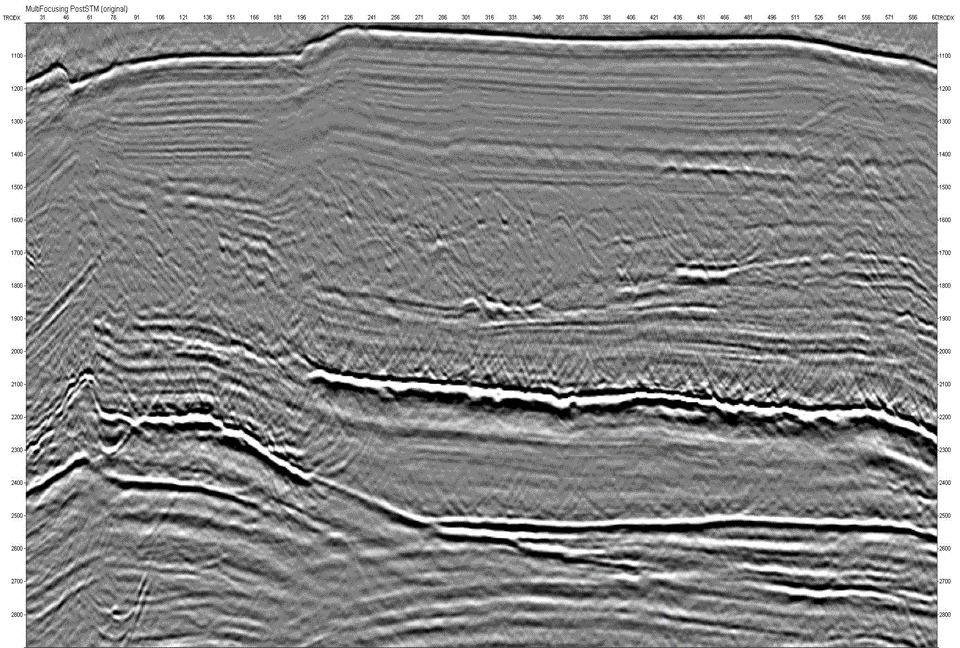
MultiFocusing Time and Depth Imaging
FAULT / FRACTURE DETECTION
Onshore seismic processing
Onshore seismic data can present a unique set of challenges, surface conditions can lead to static and noise issues and geologically complex areas can give rise to imaging problems.
- Geomage proprietary technologies can help unravel these challenges. Proprietary refraction and residual surface consistent statics provide a stable high resolution static solution
- In areas with a more complex near surface tomo or proprietary refraction statics can give clarity to the near surface solution
- Highly interactive velocity analysis gives a transparent look at the stacking and gather response of the data to topographically referenced velocity correction
- Industry leading noise attenuation and wavelet processing technologies preserve amplitude information and strip away both coherent and random noise contamination from the signal
- Multifocusing used to further improve the resolution and imaging of the data before migration. In time or depth domain, high resolution prestack migration gives the best image
- Rough topography
- Frost zone
- Sparse 3D / Low fold
- WAZ seismic
- Merge 3D
- 4D processing
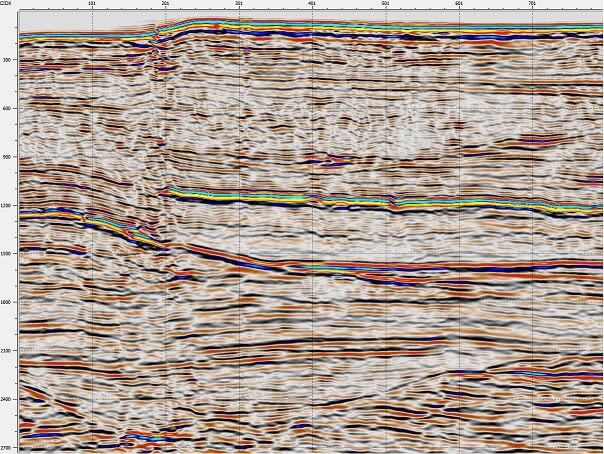
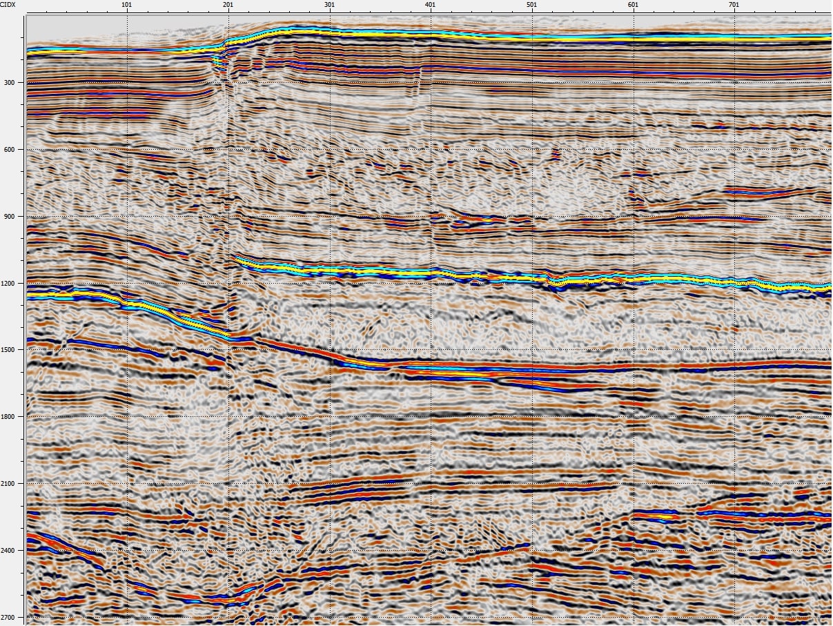
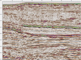
Marine seismic processing
Offshore seismic data has its own set of problems; multiples, ghosting and imaging of complex structure including salt bodies are just a few examples.
- A robust tau-p deghosting algorithm is an important part of the Geomage solution, allowing for consistent broadband marine data.
- Multiples can be attacked with a powerful radon demultiple, or advanced SRME approach, adaptive subtraction can be coupled with multiple modelling technologies to remove difficult to differentiate multiples from the data.
- In the MultiFocusing process multiples can be analyzed, identified and eliminated across multiple wavefront parameters, allowing for a clear separation of primary and multiple in the MF enhanced data.
- In the presence of complex structure or salt, MultiFocusing not only improves the imaging, but can provide detailed data driven velocity information helping identify geologic boundaries in the data.
- At later stage the technology derived velocity model gives better migration imaging in the time domain, as well as more accurate data based velocity models in the depth domain.

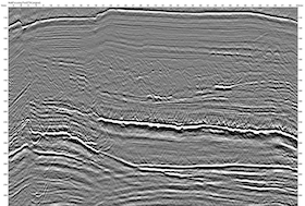
MultiFocusing Time and Depth Imaging
Geomage provides most accurate seismic data processing services with its proprietary MultiFocusing Imaging technology. Geomage MultiFocusing© imaging used successfully all across the globe for wide spectrum of different geological/geophysical conditions/problems:
- Data interpolation and regularization
- Structural seismic imaging
- Unconventional seismic
- Sparse/low-fold seismic
- Wide/Full-azimuth seismic
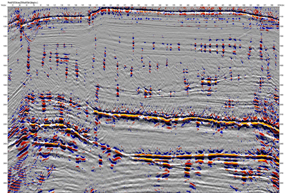
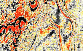
FAULT / FRACTURE DETECTION
Geomage offers proprietary direct method to detect and characterize fractures and other small scale reservoir heterogeneities.
The MultiFocusing Diffraction Imaging (MFDI) method is based on a new moveout time correction which adequately describes diffraction events. Optimal summation of the diffracted events and attenuation of the specular reflections allow creating an image containing mostly diffraction energy.
The result of the MFDI is the full-azimuth seismic image which primarily contains optimally stacked diffraction events. Integration with petrophysical data sources provides calibration information specific to a prospect area.
The diffraction cube contains important information identifying local heterogeneities and discontinuities in the subsurface. This information helps to optimize horizontal drilling and correct placement of exploration wells.